Clicca qui per la versione in italiano
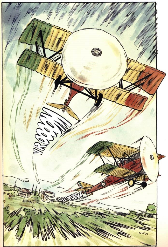
Rome-Tokyo raid of 1920
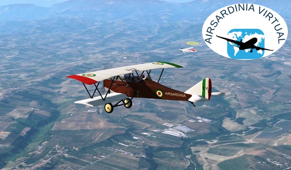
AIRSARDINIA
IN THE 100TH ANNIVERSARY OF THE ITALIAN AIR FORCE
and
DIN THE 123RD ANNIVERSARY SINCE THE TAKE-OFF FROM THE ROME CENTOCELLE FIELD OF FOUR AVIATORS WHO WROTE A GLORIOUS PAGE OF ITALIAN AVIATION
IS PLEASED TO PUBLISH THIS TOUR
2020 marked the centenary of the Rome-Tokyo Raid. There were many initiatives to commemorate the exceptional feat of our aviators of the time.
AECI Aero Club d’Italia
Comunicato stampa Comune di Induno Olona
Difesa Online.it
We wanted to wait for the publication of this Raid to be able to present it to you on the occasion of the 100th anniversary of our Air Force. An armed force that works daily (with training, technical innovations, maintenance of aircraft efficiency with highly specialized personnel) to monitor our skies and intervening to rescue the population on land and at sea (just think of the interventions during the Amatrice earthquake , the search for shipwrecked people or the emergency transport of people to qualified hospital centres). Since our aeronautics was born, many people have taken turns to maintain its efficiency over time, learning and passing on their experience to the “new” ones. Many pilots have written pages of history, many specialists have allowed it to be written. It is to remember all these men and women that we have thought of carrying out this Tour and we have been waiting for the centenary. We hope you enjoy our work.

Our Tour, born from a brilliant intuition of Massimiliano SDG055, does nothing but retrace the alleged routes of the Raid carried out in 1920. The creator (Marco SDG002), due to the lack of detailed news about it and the discrepancies that emerged between some of the traceable information, is unable to state that the routes reproduced in this Tour always coincide with those actually followed by the two SVA9 biplanes. Faced with some documentary gaps, Marco tried to think with the heads of Ferrarin and Masiero, also bearing in mind that as aids to navigation they only had a magnetic compass and geographical maps that were often very approximate, obviously as well as the coasts, the course of rivers, railways, etc.
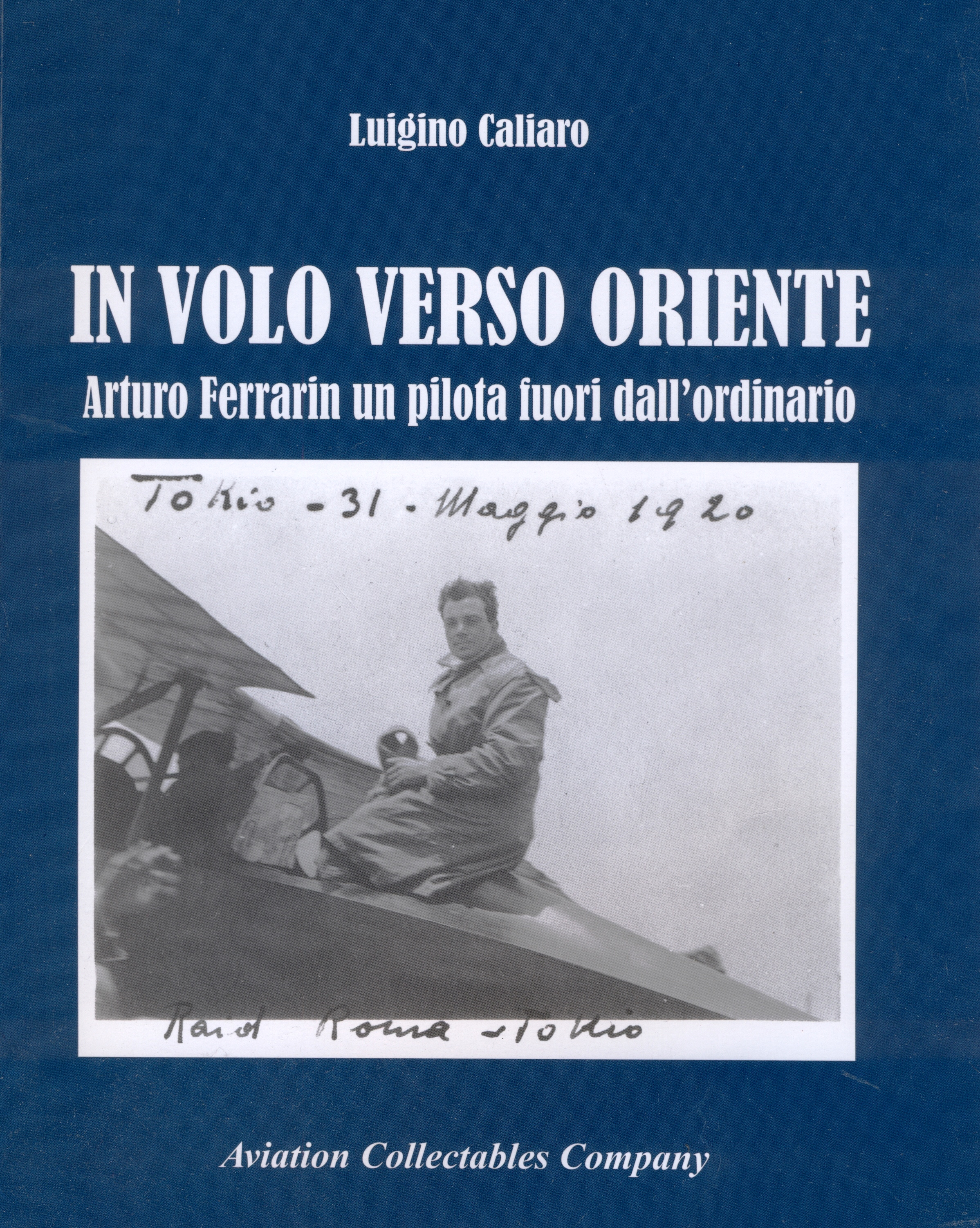
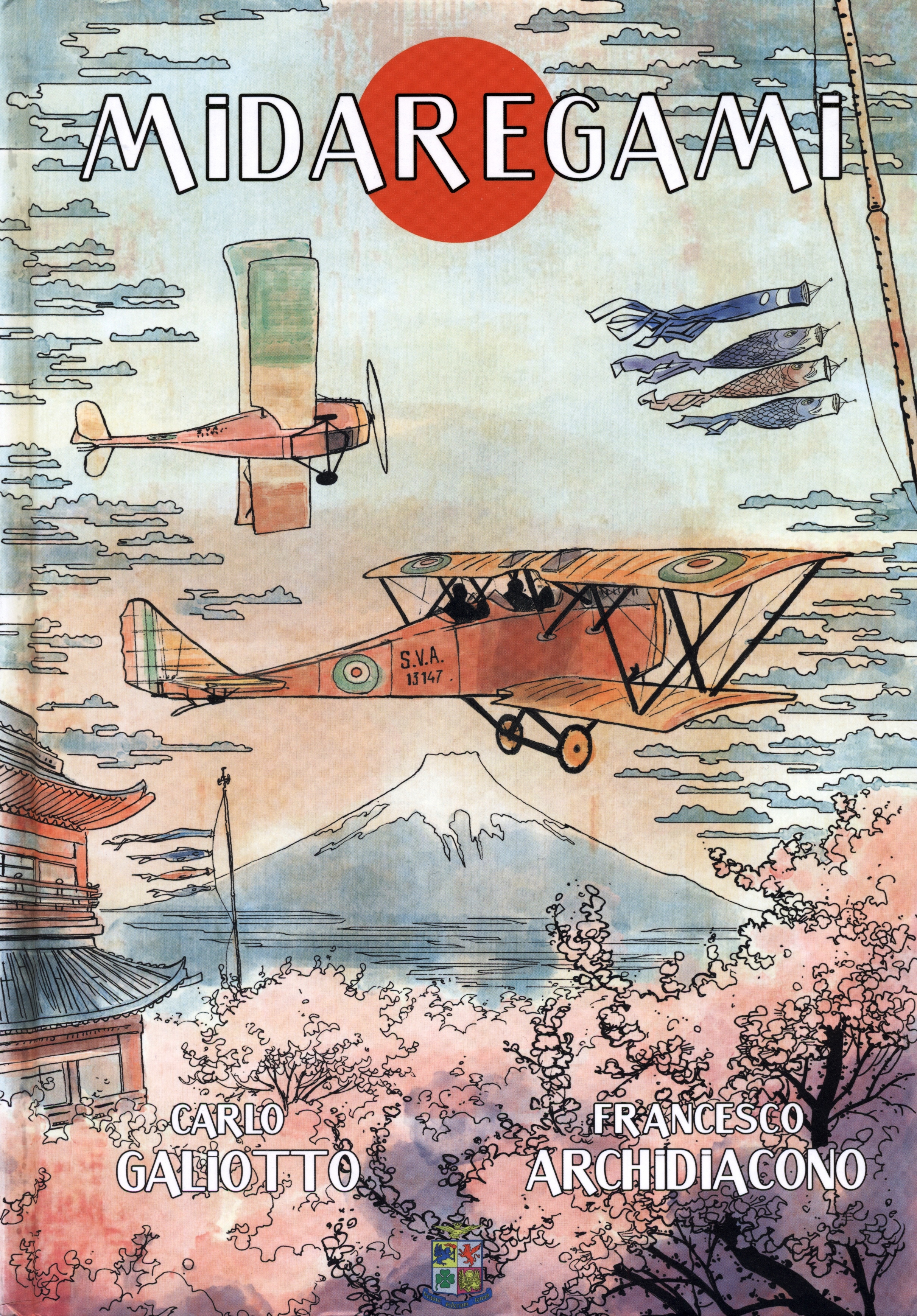
Marco was able to complete the demanding project of the Tour by drawing on documentation found on the net and on the information found in two volumes always suggested by Massimiliano, “In volo verso Oriente” by Luigino Caliaro and “Midaregami – il Volo di Arturo” by Carlo Galiotto, which we recommend the purchase and reading. In fact, during the various stages, reference will often be made to information or images taken from these texts. It should be noted that this Company, having no link or relationship with the authors or publishers, has requested and obtained from them the necessary authorizations for the quotes used in the Tour.
Sources mentioned:
“In volo verso Oriente“, author Luigino Caliaro, publisher by Aviation Collectables Company, 2020 registered office: Via Garibaldi 63 10026 Santena (TO)
Purchase Link: www.aviastore.it
https://www.amazon.it/Oriente-Arturo-Ferrarin-pilota-dallordinario/dp/8831993046
“Midaregami – il Volo di Arturo”, author Carlo Galiotto, drawings by Francesco Archidiacono, published by Edizioni Rivista Aeronautica, Rome 2020
Purchase link: https://www.amazon.it/Midaregami-volo-Arturo-Carlo-Galiotto/dp/8888180745
www.aeronautica.difesa.it/Pagine/default.aspx
NOTE: The publication of the images taken from the books “Midaregami – Il Volo di Arturo” and “In volo verso Oriente” has been authorized by both copyright holders. We sincerely thank them for giving us this opportunity.
After each leg, this article will be updated reporting the date and time of departure, all the participants (Name and proper ICAO. For example, the writer will be Marco SDG002) and a description of the flight.
Hoping that his work is to your liking, he wishes you a lot of fun.
NOTES:
- The aircraft for this Tour is the SVA9, available free of charge for FSX and X-Plane (For FS2020 and P3D, the aircraft must be a period biplane). Even the Cessna C172 is admitted, given that the domestic environment does not always allow for a continuous presence on the controls that biplanes require.
- A livery specially made for this Tour is available for X-Plane.
- Flight plans, in LittleNavMap format, will be made available from time to time
- For those who do not have the possibility to take off from Rome Centocelle, as it does not exist in their scenarios, the departure from Rome Urbe is allowed by flying over the Centocelle Park
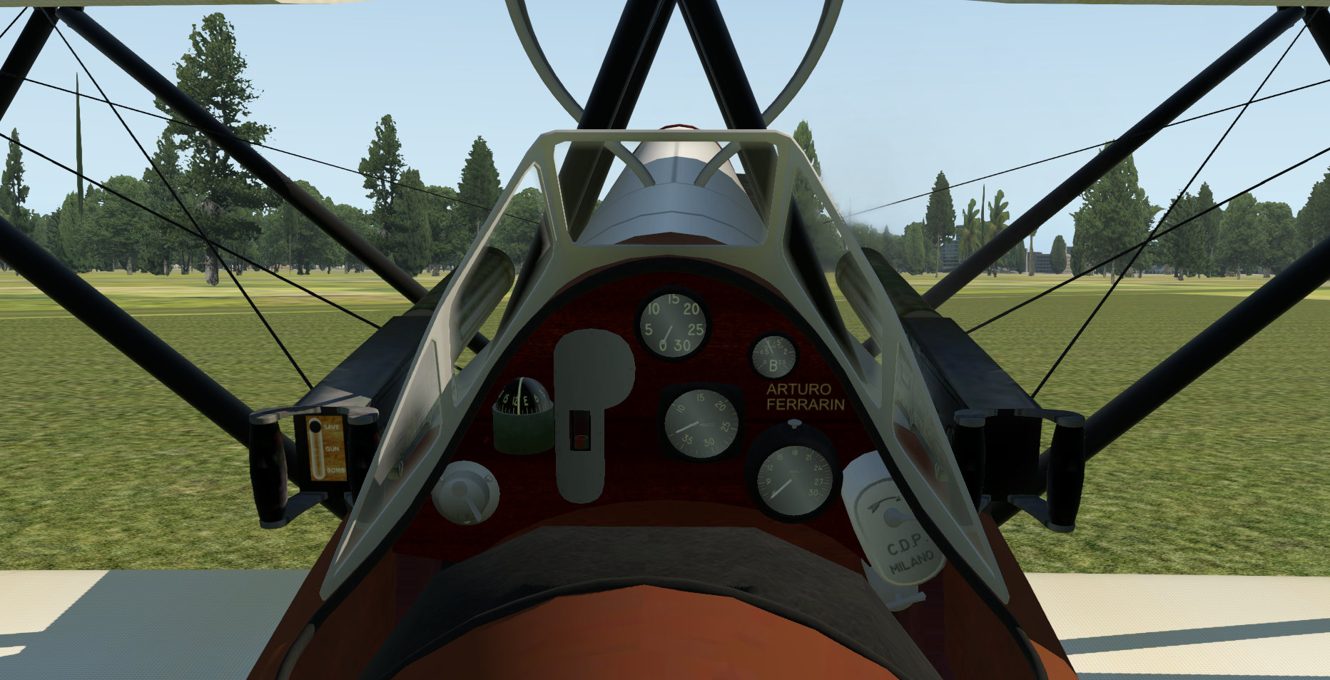
Equipment of the SVA9 aircraft:
– As a navigation system it only has a magnetic compass.
– The altimeter does not have QNH adjustment and the indications are in metres.
– It is equipped with an anemometer calibrated in Km/h
– Has trim on elevator
– Has left and right tank taps
– It has a magneto switch
– Has mixture adjustment
– Has an engine rpm indicator
– Has an oil pressure gauge
– It had no radio but it was implemented in the simulator
What is missing:
– Does not have a system to address the aircraft on the ground
– It has no artificial horizon
– It doesn’t have a virosbandometer
– It doesn’t have a variometerNon ha un sistema per indirizzare il velivolo a terra
Advice for SVA pilots (I advise controllers to read for traffic management):
- The magnetic compass can be used, since it tilts, as a very free-range artificial horizon
- Due to the lack of a system to address the aircraft on the ground (in reality it was accompanied to the nose by the technicians who guided it by holding it by the wings) it is advisable to get on the grass near the nose at an angle of about 45° with respect to the runway alignment. As soon as you get enough speed, it becomes steerable.
- To convert from meters to feet, multiply the meters by three to get a sufficient approximation
- To convert from km/h to knots, divide by two to get a good approximation
- Not having any navigation system, apart from the magnetic compass, I advise you to immediately get on the planned route by identifying, in the distance and on your route, some points that you can distinguish well. Over time you may see it drifting to port or starboard, evaluating the offset will allow you to make the heading correction for drift.
- After reaching the point, if you are aligned as per your planned course, continue. If not, change course, steer to the point and then resume the planned course.
- The aircraft tends to bank to the right. Therefore, you can exploit an aircraft bug to help you. The side trims did not have them but they work.
- The aircraft maintains equilibrium stability for a very short time, do not move away.
- The aircraft was flown to be as low as possible. It was used to be able to read the road signs.
- Upon landing, again due to the lack of directionability on the ground, when the aircraft begins to become unmanageable, exit the runway and stop on the grass.
- In adverse weather conditions the flight will have to continue anyway and it could happen that the pilot loses track of his attitude. I recommend keeping an eye on the tilt of the magnetic compass. The flight, being rectilinear and with few altitude changes, provides approximate attitude indications but… always better than a punch in the eye.
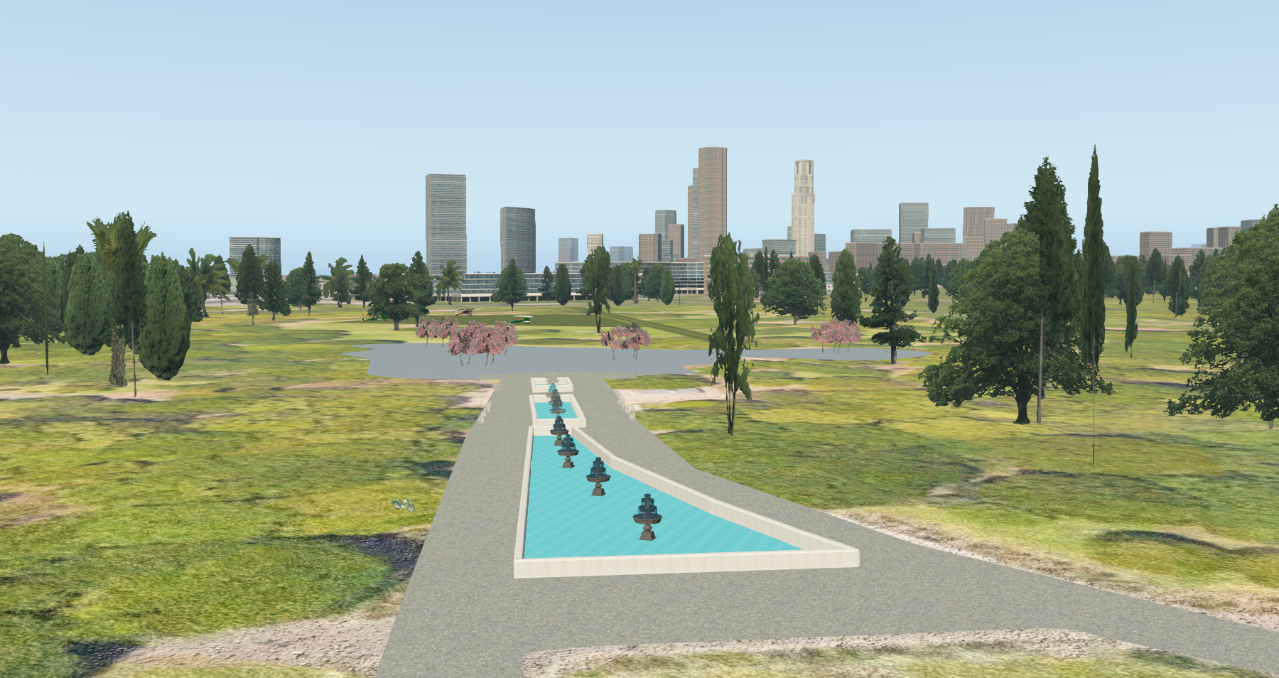
Scenarios:The scenarios of Rome Centocelle airport are available for XPL11 and XPL12 both created by Marco SDG002 and for FS2020 created by Antonello SDG001. The scenario was created with great difficulty due to the very scarce photographic or video images available on the net. Because of these difficulties, the scenario writers tried to build a scenario based on the historical period and their own experience. Obviously, even the surroundings are unreal given the urbanization of the surrounding area that took place from the 1950s onwards. For XPL users (11 and 12) there are already numbered pitches to be able to occupy, while for FS2020 they are still under construction. The pilots will connect and, if the pitch is already occupied, they will move around the meadow at will.
Click here to download the Rome Centocelle scenery for XPL 11 and 12
Click here to download the Rome Centocelle scenery for FS2020
Click here to download the Yoyogi Park scenery for XPL11 and 12 (we advise you to add your orthophoto)
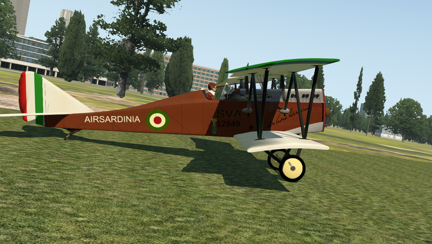
The SVA 9 which we are giving you to download for XPL, comes complete with aircraft and livery. The aircraft was downloaded from https://forums.x-plane.org/index.php?/files/file/42150-ansaldo-sva/
Click here to download the SVA9 for XPL
Click here to download the SVA9 CSL for XPL
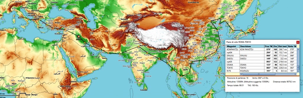
The VACCs of the nations we will fly over are being contacted in order to obtain ATC assistance and invite their pilots to participate. For the moment Legs 1-2-3-4-5-6-7-8-9-10-11-12-13-14-15-18-28-33 have been identified
Route list:
NOTE: The tour should start on February 14, 2023 at 11 local time. It will be a Tuesday and it is difficult, if not impossible, to have a fair initial participation. Therefore we are thinking of postponing the time to 21 local time or postponing the departure to another day of the week. As soon as the decision has been made, we will publish the final date and time. Keep checking it from time to time.
| Departure | Destination | Nautical Mile | Zulu departure date and time |
|---|---|---|---|
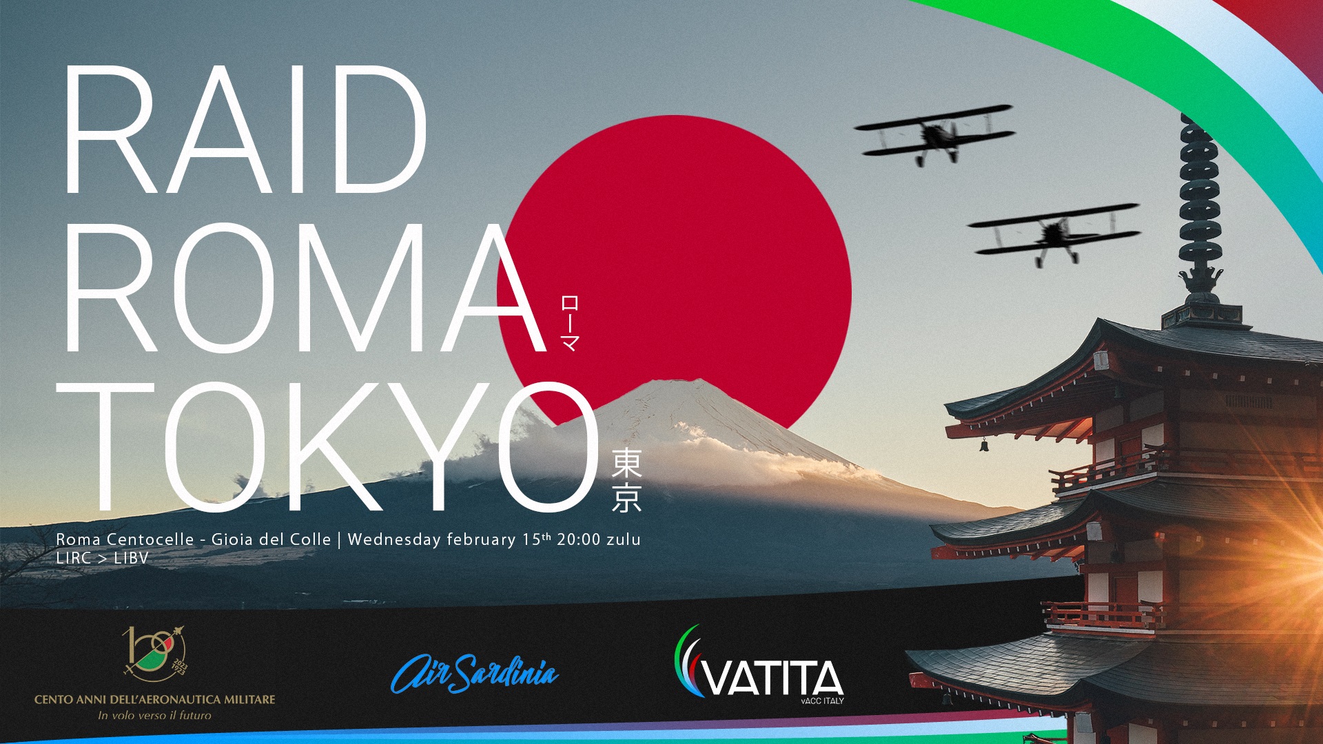
| Roma Centocelle | Gioia del Colle | 260 | 15/02/2023 ore 20.00 Z |
| Gioia del Colle | Valona | 120 | 28/.2/2023 ore 20.00 Z |
| Valona | Salonicco | 170 | 08/03/2023 ore 20.00 Z |
| Salonicco | Smirne | 230 | 17/03/2023 ore 20.00 Z |
| Smirne | Aydin | 60 | 24/03/2023 ore 20.00 Z |
| Aydin | Antalya | 170 | 26/04/2023 ore 20.oo Z |
| Antalya | Aleppo | 340 | |
| Aleppo | Baghdad | 400 | |
| Baghdad | Bassora | 260 | |
| Bassora | Bushir | 240 | |
| Bushir | Bandar Abbas | 340 | |
| Bandar Abbas | Caiubar | 310 | |
| Ciaubar | Karachi | 390 | |
| Karachi | Delhi | 630 | |
| Delhi | Allahabad | 330 | |
| Allahabad | Calcutta | 410 | |
| Calcutta | Akyab | 300 | |
| Akyab | Rangoon | 280 | |
| Rangoon | Bangkok | 350 | |
| Bangkok | Ubon | 270 | |
| Ubon | Hanoi | 450 | |
| Hanoi | Macao | 450 | |
| Macap | Canton | 80 | |
| Canton | Foochow | 470 | |
| Foochow | Shanghai | 340 | |
| Shanghai | Tsingtao | 350 | |
| Tsingtao | Pechino | 330 | |
| Pechino | Kowpangtze | 390 | |
| Kowpangtze | Pyongyang | 460 | |
| Pyongyang | Seoul | 120 | |
| Seoul | Taikju | 140 | |
| Taikju | Osaka | 420 | |
| Osaka | Tokyo | 240 |
01 Roma Centocelle LIRC – Gioia del Colle LIBV MAP FLIGHT PLAN FORMAT LNM
Flight plan: SETTECAMINI GUIDONIA TORNIMPARTE COLLEROIO PENNE FRANCAMARE ORTONA SANVITOCHIETINO SANSEVERO 2NMNORDLUCERA TROIA STORNARA 2NMSUDCANOSA GRUMO

We will leave from Centocelle (Roma Urbe for those who don’t have the scenery) heading towards Settecamini and then continue towards Guidonia. Therefore, maintaining a course of 049° we will fly over Tornimparte and then Colleroio. As a route check, we will have to leave Lago del Torano and Lago del Salto on our left. Then we will continue in the direction of Penne without worrying about the correct route. Sooner or later we will spot the Adriatic and the city of Pescara which we will fly over and then stay along the coast in a south-easterly direction. Approaching Termoli, we will keep the same route moving away from the sea. Above the town of San Severo we will turn right to go around the city of Foggia in an anti-clockwise direction. Going around Foggia, we will continue to Stornara and then keep the same route until we cross the city of Bari. We will then veer right to approach Gioia del Colle.
02 Gioia del Colle LIBV – Valona LAVL MAPP FLIGHT PLAN FORMAT LNM
Flight plan: OSTUNI BRINDIPORTO SAZANISLAND
No accurate details for this leg. I took geographic reference points that didn’t change with time and used them to verify the route followed during the flight. Head to Brindisi, passing via Ostuni, then proceed on the sea until the island of Sazan.
03 Valona LAVL – Salonicco LGTS Map
Flight plan: PRESPALAKE VEGORITIDALAKE
I could have made a direct route, but I preferred deviating north to verify the route over Lake Prespa and Lake Vegoritida.
04 Salonicco LGTS – Smirne LTFA Map
Flight plan: TORONEOSGULF AGIOSTRATIISLAND LESVOSISLAND FOCA
I took advantage of the gulf of Torones as a starting point for the crossing of the Aegean Sea. Afterwards I used the islands Agios Efstratios and Lesvos to verify the route and the town of Foca to approach İzmir.
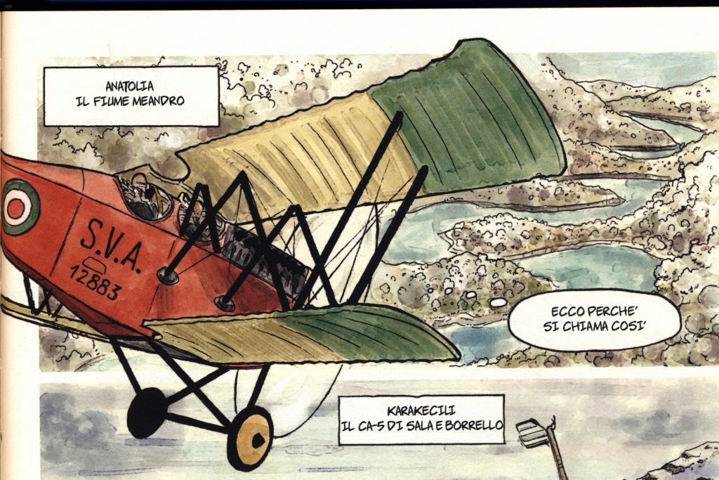
05 Smirne LTFA – Aydin LTBD Map
Flight plan: SMIRNEPORT
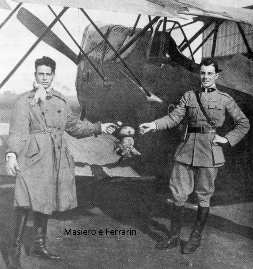
Considered the small distance, this leg is a direct flight overflying İzmir’s harbour, again as a starting point. Here the only available reference, I had a note about the flight of Masiero and Maretto. Because of mechanical problems, they had landed on the shore of the Menderes river, where they were helped by greek pilots.
06 Aydin LTBD – Antalya LTAI Map
Flight plan: SOUTHNAZILLI BOZDOGAN KEMERLAKE SALDALAKE
Here, the only reference I had was a note in regard to the flight along the valley of the Menderes river. Therefore, after the takeoff, I followed the river until the town of Nazili. Then, I left the town heading south, towards the Kemer Lake, verifying the route on the city of Bozdogan. From the lake I headed east to reach lake Salda, the next turning point. There I turned south east, approaching Antalya.
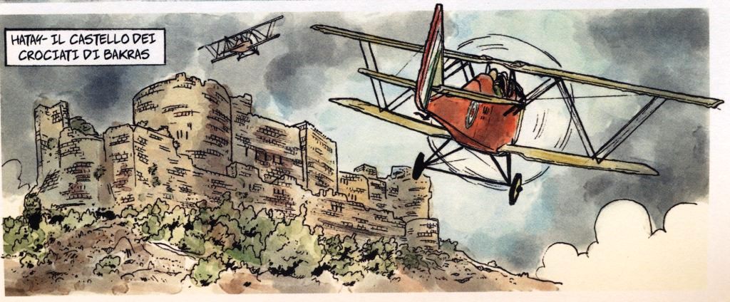
07 Antalya LTAI – Aleppo OSAP Map
Flight plan: MANAVGAT ALANYA GAZIP BOZYAZI SIPAHILI DALYAN ALESSANDRETTAGULF ISKENDERUN HIT RAMADI

Imagining that Ferrarin avoided flying over mountains that were too high and that on the direct route to the gulf of Alessandretta he would have climbed more than 9,000 feet, I thought it was convenient to follow the coast even at the cost of lengthening the route. The only useful port for the route is the Gulf of Alessandretta and the city of Iskenderun from which to sail to Aleppo.
08 Aleppo OSAP – Baghdad ORBI Map
Flight plan: MOUTHMUSHAYRIFAH ALRAQQAH HUWAYJATSHINAN JUDAYDAH ALTIBNI SUBAYKHAN ALQAIM RAWA MOUTHEUFRATE HADITHA
Here, as information, I have the note from Masiero who says he followed the Euphrates River in order not to get lost, due to the poor visibility caused by the rain.
09 Baghdad ORBI – Bassora ORBS Map
Flight plan: ABDARRAHMA KUT SHAYKSAD ALAMARA
Here they followed the Tigris River.
10 Bassora ORBS – Bushir OIBB Map
Flight plan: MOUTHTIGRI
Here I follow the Tigris River to the delta and then skirt the Persian Gulf to the finish.
11 Bushir OIBB – Bandar Abbas OIKB Map
Flight plan: 27°52’N051°25’E LAR
Here we follow Ferrarin’s route. He first he stayed along the coast and then made a direct course passing over the mountains.
12 Bandar Abbas OIKB – Caiubar OICZ Map
Flight plan: CIAUBARGULF
Based on the information found, Ferrarin followed the coast, sometimes flying over desert areas. Returns to the sea were caused by the intense heat and sand clouds which blocked the view. Near Ciaubar he took off and landed coming from the sea.
13 Ciaubar OICZ – Karachi OPMR Map
Flight plan: CIAUBARGULF SOUTHORMARA SOUTHKUNDMLAIR
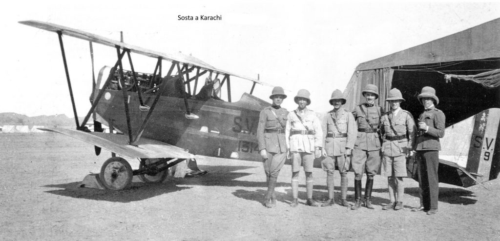
Here, too, the coast was followed. Due to a breakdown they made a crash landing and had a nice adventure.
14 Karachi OPMR – Delhi VIDD Map
Flight plan: LAXMANGARH SIKAR RINGAS NARNAUL REWARI HAILEYMANDI
After take-off, Ferrarin crossed the Thar Desert, then followed a narrow-gauge railway to Delhi. It was not easy to find the route of the railway line. Therefore I imagined that the line would touch some more important localities on its way to Delhi.
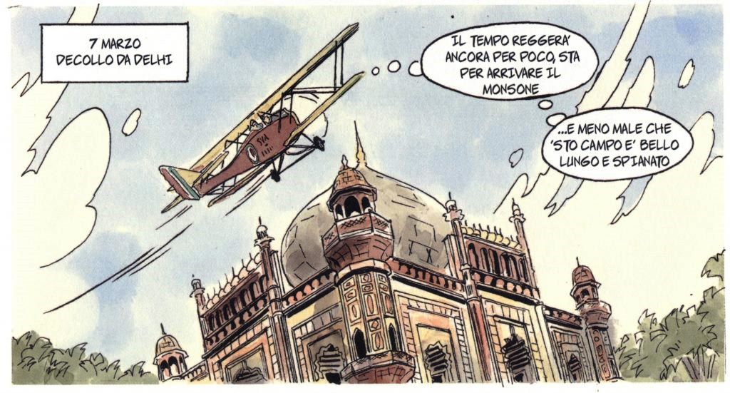
15 Delhi VIDD – Allahbad VEAB Map
Flight plan: YAMUNARIVER MATHURA AGRATAJMAHAL KANPUR
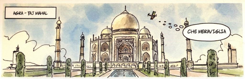

Here is some conflicting information. Describes the flight over the Ganges and the passage from Agra and the Taj Mahal. Source “In volo verso Oriente”, author Luigino Caliaro page 29. Therefore our route takes us not to the Ganges River but to the Yamuna River (southernmost tributary of the Ganges). Only after Agra does the route turn towards Kanpur and then follow the Ganges River.
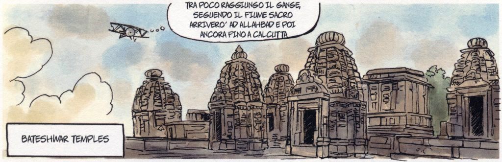
16 Allahbad VEAB – Calcutta VECC Map
Flight plan: VARANAS DEHRI BOKARO
In the absence of information, the route skirts the Ganges up to Varanasi, then bends towards Dehri crossing the Sone River and then continues to Calcutta.
17 Calcutta VECC – Akyab VYSW Map
Flight plan: 21°51’N89°52’E 20°41’N92°19’E
The only information in this regard mentions the overflight of the Ganges delta and the Gulf of Bengal. Source “In volo verso Oriente”, author Luigino Caliaro page 37. Therefore direct route towards Akyab with route verification by sighting the island of St. Martins.
18 Akyab VYSW – Rangoon VYYY Map
Flight plan: PROME IRRAWADDYRIVER NYAUNGDON

Sources say they passed large forests and mountains. Source “In volo verso Oriente”, author Luigino Caliaro page 39. Therefore, the first part of the flight passes forests and mountains, then meets the Irrawaddy River and follows it to its destination.
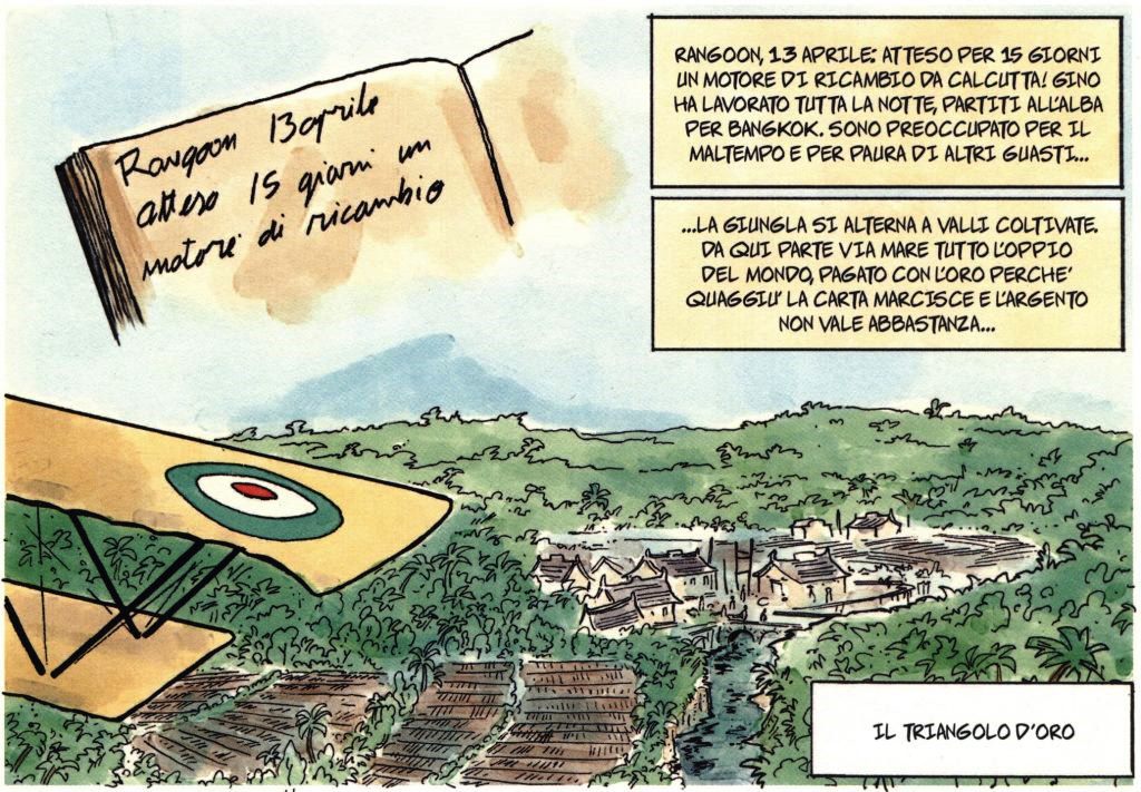
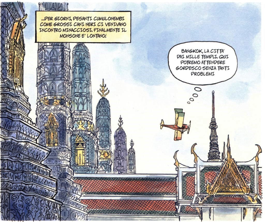
19 Rangoon VYYY – Bangkok VTBD Map
Flight plan: THONGWA MAWLAMYINE THAKHANUN NAKHARIN
The notes describe Masiero’s crash landing in the village of Tarna which I could not find in the papers. Source “In volo verso Oriente”, author Luigino Caliaro page 41. With the same method used previously, I searched for convenient conspicuous points for verifying the route.
20 Bangkok VTBD – Ubon VTUU Map
Flight plan: LAMCHAELAKE SURIN SISAKET
The notes describe a flight over flat terrain filled with lush and dense vegetation to make the flight monotonous as if it were being flown over the sea.
21 Ubon VTUU – Hanoi VVGL Map
Flight plan: DONGHOI VINH THANHHOA PHULY
The route, as described, heads towards the sea and then follows the railway line up to Thanh Hoà and then heads towards Hanoi flying over the town of Phu-Ly. Source “In volo verso Oriente”, author Luigino Caliaro page 43.
22 Hanoi VVGL – Macao VMMC Map
Flight plan: HALONG BEIHAI ZHANJJANG CHAWANBAY
They flew over the coast so as not to lose their way and so will we.
23 Macao VMMC – Canton ZGGG Map
Flight plan: ZHUJIANGMOTH

I have no news here, it occurred to me logically that they followed the Zhu Jiang River to Canton.
24 Canton ZGGG – Foochow ZSFZ Map
Flight plan: HUIZHOU SHANWEI DAGANG JINGHAIZHEN SHANTOU LAIWUPENINSULA LAIYUISLANDS XIAMEN QUANZHOU PUTIAN DONGJJNDAO
Here Ferrarin, at the request of the governor of the city, flew over the inhabited centers to show the population an airplane in flight for the first time. Furthermore, due to the bad weather, Ferrarin was repeatedly tempted to go down to the beach. So this section remains on the coast flying over inhabited centres. Source “In volo verso Oriente”, author Luigino Caliaro page 51.
25 Foochow ZSFZ – Shanghai ZSSS Map
Flight plan: DAYUSHAN DONGSHAN LINHAI NINGBO
Having no news, I decided to continue on the coast, flying over the towns up to Shanghai.
26 Shanghai ZSSS – Tsingtao ZSQD Map
Flight plan: LIANYUNGANG
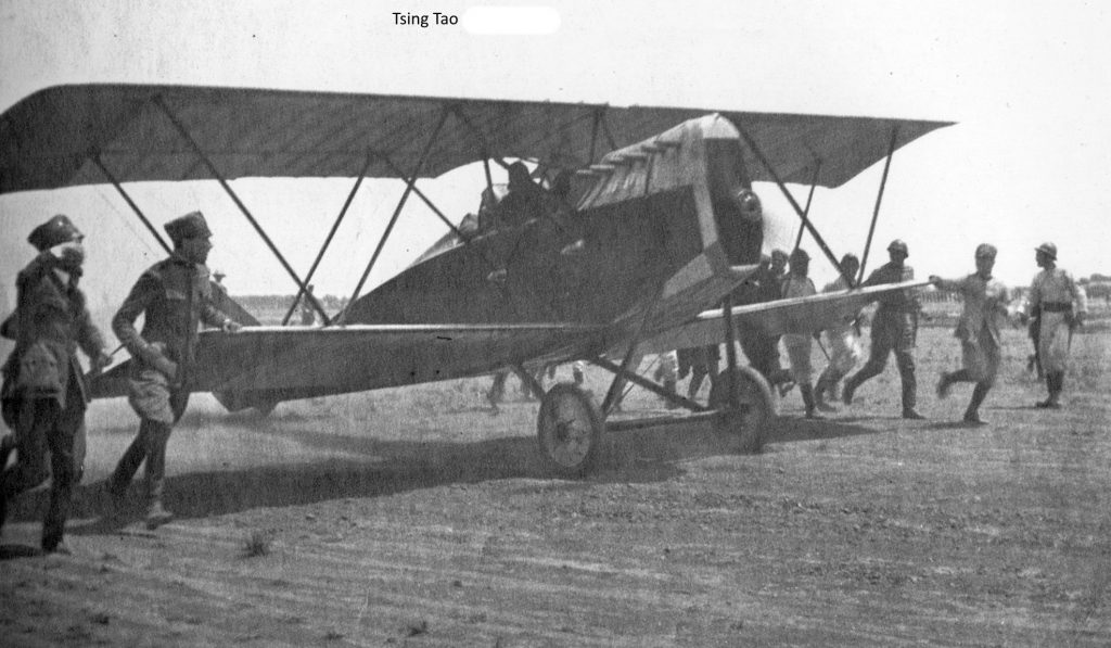
Here we have reports of overflights of arid and sandy terrain. Therefore I decided to stay inside, even with a view of the sea up to the town of Lianyungang and then continue on a stretch of sea up to Tsingtao.
27 Tsingtao ZSQD – Pechino ZBBB Map
Flight plan: Tientsin Yongdingriver
Again no written reference. It came to me logical to think of a direct route to the mouth of the Yongding River and then up it to Beijing.
28 Pechino ZBBB – Shenyang ZYYY Map
Flight plan: GREATWALLMUTIANYU GREATWALLLIANHUACHICUN BAITAISHANGLAKE HUAIROU QINHUANGDAO GREATWALLSHANHAI HULUDAO KOWPANGTZE
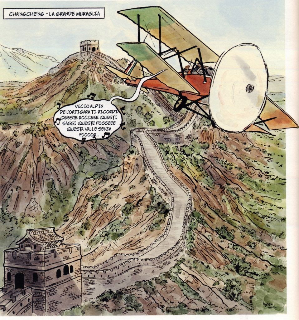
Here we have a note relating to the flight over the Great Wall of China which “rises on rocky hills, winds its way through verdant hollows and runs straight over long plains to the sea”. Source “In volo verso Oriente”, author Luigino Caliaro page 67. It was not easy to find which section of the wall he had flown over. After careful research, I have come to the conclusion that it flew over the section of the wall which is about 35 miles northeast of Beijing. From there, after following her for a while, I assumed she made a direct course out to sea where, after following the coast to the end of Liaodong Gulf, she made a direct course to Kowpangtze. Unfortunately, this location does not have an airport where you can land, therefore, after flying over the Kowpangtze location, it will head for Shenyang.
29 Shenyang ZYYY – Pyongyang ZKPY Map
Flight plan: YINGKOU LUSHUNKOUPORTARTURS SINUIJU
Here it must be pointed out to the participants that Ferrarin took off from Kowpangtze for Shingishu (location that I have not been able to trace) and then for Seoul. Source “In volo verso Oriente”, author Luigino Caliaro pages 67-68-69-70. Therefore I had to adapt the route with an intermediate landing in Pyongyang. Also, as per sources, it flew over Port Arturs and Sinuiju locality.
30 Pyongyang ZKPY – Seoul RKSK Map
Flight plan: YONTANHOLAKE
Here the route is direct to Seoul, there are only about a hundred miles. Furthermore, Seoul is on the sea and therefore it is enough to keep an eye on the compass and another to try to spot the sea.
31 Seoul RKSK – Taikju RKTN Map
Flight plan: YONGIN EUMSEONG SANGIU
Here the information reports a short journey through mountainous and arid regions. Source “In volo verso Oriente”, author Luigino Caliaro page 69.
Therefore, having seen the territory, I imagined an almost direct route.
32 Taikyu RKTN – Osaka RJOO Map
Flight plan: BUSAN TSUSHIMANORTH NAGATO MASUDA MATSUE TOTTORI NISHIWAKI
Here the news is also detailed enough that I won’t report it, it would be too long, and not worthy of Caliaro’s writing. Source “In volo verso Oriente”, author Luigino Caliaro page 70. I leave the floor to the flight plan.
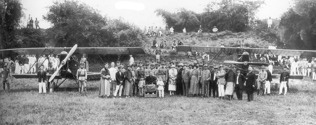
33 Osaka RJOO – Tokyo RJTF Map_01 Map_02
Flight plan: SHIZUOKA YOYOGIPARK

We are at the end of the Tour. The pilots landed in Yoyogi Park, today it could be feasible, a lot depends on the scenario available to you and your abilities. Airsardinia pilots will be able to complete the route in the park, even if in the Acars flight plan, the arrival is scheduled at RJTF.